While we were loading the equipment and things that we would need on our four day trip, I could hear the slow rain hitting the leaves that had started turning color for yet another
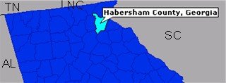 season. Our plan was to leave before daylight so we would be crossing Chunky Gal Mountain at sun up, it had been four years since I had seen her in full color. We would be in three states and along three different National Forest before reaching Alec Mountain in Habersham County, Georgia before noon. The county is located in the Northeast part of the state and is the first county in Georgia that corundum had been found, not by prospecting for corundum but by the prospector looking for the shiny yellow metal... GOLD!
It was still dark and a light misting rain was still falling as we started our trip, I was hoping that the weatherman was right about the rain ending before day break, but the drive along the winding Ocoee River in the Cherokee National Forest was met with areas of rain and fog. We still had an hours drive before we would enter the Nantahala Forest at the foot of the Gal, maybe by then the weather would be clear, but it was not to be. The Nantahala Forest sign was only a
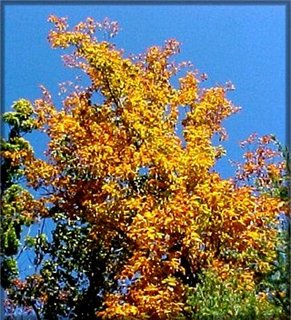
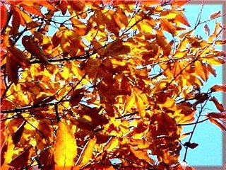
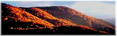 dim glance as we started up Chunky Gal Mountain, even the Buck Creek turn off that I had made many times took a second look, the Gal had a large blanket of white and the only thing to be seen was the center line on the lonely black highway. It was no better as we passed Standing Indian, my emotions was starting to hit yet another low side for the month of October, as we got closer to Winding Staircase I could see a break as the morning sky was starting to get brighter. Well, I might get a small chance to see some of the Gal in full color, I thought. Coming through the gap I could see the sun starting to rise over the mountains, the light danced across every high peak then struck the Gal's east side, I can't even begin to describe my feelings at that time! The Gal was on fire with every color of red, orange, yellow, and gold!
... as if to say, "You didn't think I'd let you visit without saying hello, did ya?!"
dim glance as we started up Chunky Gal Mountain, even the Buck Creek turn off that I had made many times took a second look, the Gal had a large blanket of white and the only thing to be seen was the center line on the lonely black highway. It was no better as we passed Standing Indian, my emotions was starting to hit yet another low side for the month of October, as we got closer to Winding Staircase I could see a break as the morning sky was starting to get brighter. Well, I might get a small chance to see some of the Gal in full color, I thought. Coming through the gap I could see the sun starting to rise over the mountains, the light danced across every high peak then struck the Gal's east side, I can't even begin to describe my feelings at that time! The Gal was on fire with every color of red, orange, yellow, and gold!
... as if to say, "You didn't think I'd let you visit without saying hello, did ya?!"
After a short visit and a cup of coffee we continued on into Franklin and turned south on 441 heading for our next National Forest, the mighty Chattahoochee with its 3/4 million plus acres in North Georgia. The name "Chattahoochee" is the white man's lame attempt to give it an Indian sounding name, the Indians call this area "Painted Rock" or "Marked Rock" and in the next few days I would try to keep with the name with some "marking" of my own!
We arrived around 10:00 on the west side of Alex Mountain, we had made plans to prospect on both sides of the forest road that we had visited a month earlier, this being around the
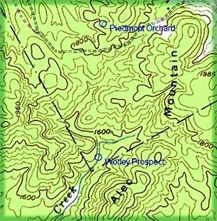
prospects of the Piedmont Orchard and the Worley Prospect in an area covering about 2,000 acres.
Getting a late start, we decided to concentrate our efforts on the Piedmont Orchard prospect and surrounding area on the north side of the Forest Service Road, I had obtained the "exact" coordinate from a current geology map making the location of the prospect an easy one being a 1/4 mile from the road. After checking the GPS, and getting a compass direction, we put our packs on and headed north. The forest was thick, it looked like a fire had burned a large area on this side of the road a few years earlier making the under brush difficult to walk through, the
 "exact" location was found in about an hours time. Now I'm not the brightest penny in the pile, but I can tell you without question that you will not find corundum in a mica/quartz deposit! After looking for an hour we didn't find any signs of a amphibolite/chlorite type deposit, which the old books stated it was in. I think I said something like "Damn Ist" at the time! Ha!
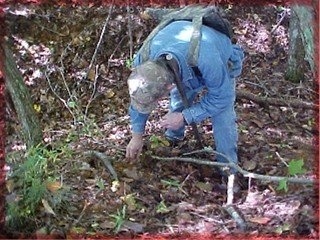
We decided to look on the next hill to the north and soon found the type deposit the prospect was reported to be in, a short time later a dirt mound was spotted further up on the side of the hill. Checkmate! The old prospect was about 40 feet long and up to 10 foot wide and at one end it was about 7 foot deep, it didn't look as if it had been visited in several years.
"exact" location was found in about an hours time. Now I'm not the brightest penny in the pile, but I can tell you without question that you will not find corundum in a mica/quartz deposit! After looking for an hour we didn't find any signs of a amphibolite/chlorite type deposit, which the old books stated it was in. I think I said something like "Damn Ist" at the time! Ha!
We decided to look on the next hill to the north and soon found the type deposit the prospect was reported to be in, a short time later a dirt mound was spotted further up on the side of the hill. Checkmate! The old prospect was about 40 feet long and up to 10 foot wide and at one end it was about 7 foot deep, it didn't look as if it had been visited in several years.
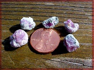
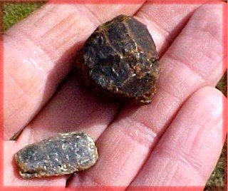
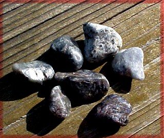
Knowing it would be getting dark in three hours, we started looking for small pieces of pink/red corundum wrapped in aggregates of green and white margarite, this is what the old books described as the type corundum to be found at this site.
We looked for over an hour and found several pieces of small corundum that was sub gem grade ruby.
The exact location was noted before we left to look around for other deposits of the same type rock. We did locate another formation at the bottom of the hill, this location was also noted before we returned to the road. The sun was getting low and a hot meal and shower sounded real good!
That night I looked over the maps and studied my notes for the next days prospect which didn't look to be that big of a deal, but I knew from passed experience that the real world can be totally different than what's on a map! 30 years ago I could eat that mountain for breakfast, at my age now, I was hoping it wouldn't have me for lunch! The Worley Prospect sits about 1 1/4 mile south of the NF road where we will park, walking distance will add about 1/3 or more to the total, you're not going to walk a straight line from point "A" to point "B" in a thick forest! The difference in elevation is about 300 to 400 feet from road to the prospect, but you can't always follow contour lines on a map when the area is full of hollows and ridges as it is at this location. Being "turned around" is not an option in this type terrain!
The next morning broke with a clear sky, the cool fresh air was in the mid 40's with a high to be around 65, I couldn't have ordered it any better! A 45-minute drive put us back on Alec Mountain, we parked next to the property line between NF land and private land. Note on above map where it says "Orchard", the white square is private property, the corn field is setting on a pegmatite formation that does have black tourmaline, but don't tell the owner we looked!
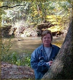
After about a hundred yards into the forest, Pat asked... "Are you sure!?", I said no, we'll be eaten by bears and panthers! Needless to say this didn't go over very well in a thick forest where you could only see 25 foot in front of you! I told her to relax, no problem, and she could enjoy the view... as long as she looked UP!
About every 100 yards we would stop to get a location fix, to take a break, and to check out yet another purdy yard rock.
Remember, when you are prospecting... "you are at where you are going". So, take the time to look around, but make sure of your present location at all times. We needed to find a clear overhead each time so the GPS could lock-on to several satellites for an accurate location.
We looked in several water run-offs and out crops as we made our way to the Worley Prospect. This mountain has been mined for several different minerals in past history, kyanite, corundum, anthophyllite, garnet... oh yes, almost forgot.. even gold!
We found gold flakes in EVERY part of moving water on the mountain, I'll bring my pan next time!
Garnet and Kyanite could be found at many points along the way too!
We hit the head of Amos Creek and followed it down to the Worley Prospect, this was almost like a paved highway compared to parts of the woods!
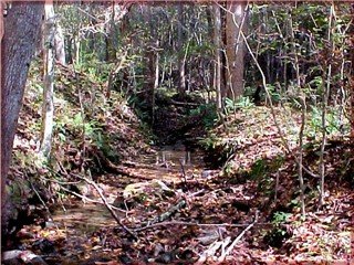
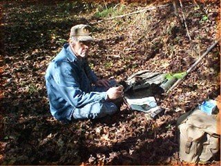
We ate lunch next to the creek at the prospect, it was a time to rest, check notes, drink coffee, mark territory, and to look around the old prospect and creek for signs of corundum! No pictures of marking territory... sorry! Ha!
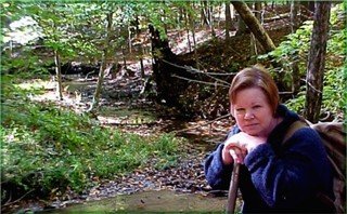
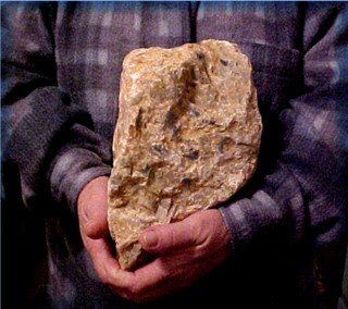
The creek had nice large pieces of yellow quartz and Pat wanted to take most of them back to put in her rock garden, until I told her the walk back to the road was up-hill! Just take a picture it doesn't weigh that much!
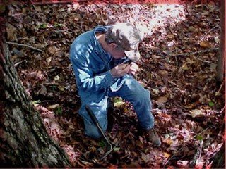
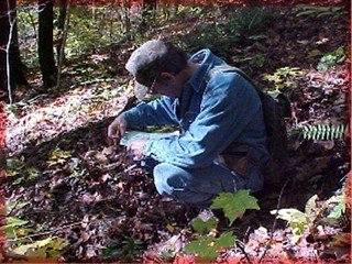
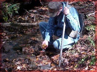
I dug around the old prospect looking for a piece or two of corundum that the old miners may have missed, I found a few that was gray with a spot of blue in some of them, even found a couple in the creek!
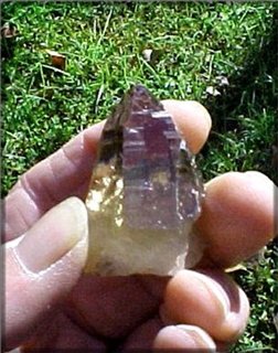
The next two days were spent looking at a few other places where a formation my contain a gem grade #9, such as a pegmatite that has blue...
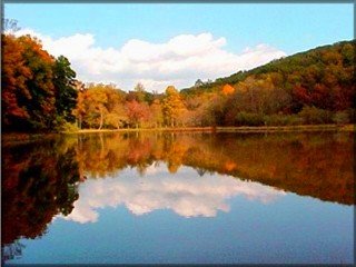
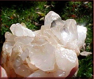
... or a slow stroll around Russell Lake, where a quartz cluster may have water clear points...
... or some road cut off the beaten path where a gem grade "smoky" could be found...
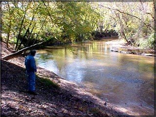
... or a slow walk along the Soque River that is littered with kyanite...
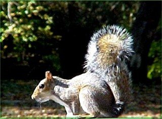
... or watching a critter collecting nuts before the dead-line called "winter" gets here...
Sorry we couldn't tell or show you everything about the different sites we visited...or the information from a "local" that may lead to "Big Red"..... or a popular dig site with many people having fun.
Yes, the path less traveled can be a lonely way to go...but, I love every minute of it!!
Wayne and Patty
CLICK THE LITTLE MINER TO RETURN TO THE FIELD TRIP PAGE
