Well, my trip to Humphrey Mtn was interesting. It resides in the southern parts of the Adirondack Mountains in New York. It is supposed to have an old garnet mine with gem quality garnet. In scoping out the trip, I bought a GPS and topo maps for this trip. I am glad I had a GPS to use for the hike. It probably saved my life.
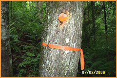
I arrived at the trail head around noon (too late in the day to start a four mile hike into the mountains). I had set a route in my GPS to follow for the trip. Unfortunately, the water and brush made me deviate from that. At one point, there was a trail. The only way you know you are on the trail is by following the little orange disks on some of the trees.
 I ended up going to the right of the stream coming down the mtn, which is supposed to lead to the garnet mine. So, I missed where it split, with the left branch going to the mine and the right branch going to the saddle between the two peaks on top of Humphrey Mountain. It took me 4 hours just to get to the saddle. I didn't see any signs of the mine so I walked up the eastern peak some to see if I could find anything. It was up on this peak that I realized I should not have hiked alone. I slipped on a few fallen trees and almost broke my leg. I had to take off my pack and pull myself up using a small pine tree next to me. Had that not happened, I probably would have found the mine. I feel confident I was within 200 yards of the mine. I decided to start heading back as it was about 5pm. I decided to follow the route that I plotted on the GPS (nice little reverse route feature). I found the stream where the two branches intersect. It is there I found the garnet chips in the stream. I dropped my pack and followed the stream up a bit but knew I would run out of daylight so I turned back.
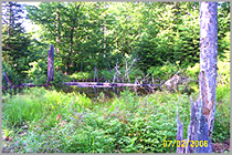
I followed the stream down until the foliage became too dense. Along the way, I found a beaver and his dam on my way down the stream
 Oh did I mention I ran out of water about the time I came across the stream intersection. I took three quarts but they didn't last long. I packed too many tools, which increased my water consumption and slowed my progress. I finally found the trail that would lead me back to the trailhead. By then I was exhausted and dehydrated. The last two miles were challenging to say the least (as was much of the trip up the mountain). But I made it and I am glad I didn't give up. I can’t imagine it would be any fun being eaten by wild animals…LOL.
I am looking forward to making the trip again but next time I will take more water, less tools and plot a more direct route to the upper part of the stream so I can follow it to the mine. I made the mistake of following the orange-disked trail referenced in a trail book for the Adirondacks. A direct route would save time and energy. There is not true trail to follow anyway. Any trails that were there have disappeared from the growth and death of the plants and trees within of the forest. Next time I won't be going alone either, maybe.
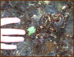
Here are some more pictures from my hike. I didn’t include pictures of the garnet chips because I don’t think they would look like much.
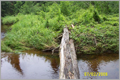
Yes, I had to cross over
this log twice and
no I didn’t fall in.
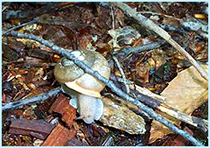
I found a friend!
| |
Something tells me I’m not alone!
Moose don’t eat humans do they?
|
