Many of us have a "To-Do" list, things we plan to do sometimes in the future. I have a list of the different mines, prospects, and deposits I'd like to vist or find. One corundum mine has been on my list for about 20 years, or so. The name of this mine is the Laurel Creek Corundum Mine. I guess the reason for not going over the years is because the main trail to the mine starts on private property. I've never been one to ask "may I?" and have passed up several mines on other people's property. I know one mine that had gem-grade blue, but have never stopped to ask..."May I?!"
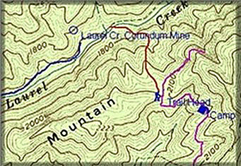
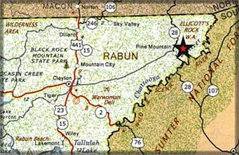 The Laurel Creek Mine is located in the Chattahoochee National Forest in Rabun County, Georgia, which is in the top right corner of the state.
To the north is the Nantahala National Forest of North Carolina and east, across the Chattooga River in South Carolina, is the Sumter National Forest. Rabum County has over 155,000 acres of the 3/4 million that the Chattahoochee has in North Georgia and, with several state parks and forest, it makes it number one in the state for public land.
The mine area has been worked off and on for corundum and asbestos. The mine
 was first worked for corundum in 1873 and closed September of 1893 after a 200
foot cube of dunite caved in, which closed off the main workings. This mine and Corundum Hill in NC supplied the major part of the world's corundum during that time. The Laurel was known as the "Big Block Mine", with corundum in masses up to 5,000 pounds each... the largest known in the world!
was first worked for corundum in 1873 and closed September of 1893 after a 200
foot cube of dunite caved in, which closed off the main workings. This mine and Corundum Hill in NC supplied the major part of the world's corundum during that time. The Laurel was known as the "Big Block Mine", with corundum in masses up to 5,000 pounds each... the largest known in the world!
Over the last several month I've been working on a possible alternate route to the Laurel. I knew the NF had added another road since the topo map on my software was made. On our last trip to NC and GA, we went to the ranger station in Clayton, GA to pick up a current topo "forest map". A forest map is the same as a regular topo, but is usually two-color showing the location of private and National Forest Land. Forest Road 646 cuts across the top of Carrol Mountain on the south side of Laurel Creek and this road would be my focus for a possible trail down to the mine. Using several different maps and the Maptech software, a trail head was chosen.
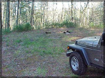
We located a very nice spot for a base camp to use on future trips to the area.
Loaded with several printed maps over-layed with the UTM coordinates, we started our walk which would take us off the north side of Carrol Mountain. The drop was 370' in 1,500' walking distance to the creek at the bottom and would put us about 100 yards east of the mine. Even by it being early spring, the foliage had already made seeing passed 50 yards impossible! A GPS reading was taken about every 75 to 100 yards to keep us on track.
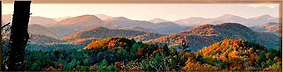
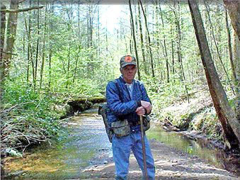
You can get turned around in this area of the Appalachians, all the rolling hills and dells look the same... this is where your navigation skills are really put to the test! At the bottom, the Laurel Creek flowed like a creek full of diamonds in the early morning sunlight!
Millions of books, pages, and pieces of biotite mica littered the creek! This made seeing a flash from corundum.. impossible! Also in the creek was orange, red, and white quartz and some smaller pieces were water clear. Pieces of feldspar, some with small slivers of kyanite and some deep-green chlorite was also noted to be in the creek.

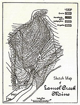
The geology on both sides of Laurel Creek is biotite/muscovite gneisses and schists with a little granite in places. It also has a strip of hornblede gneiss that crosses the creek near the mine. The mine itself being around an intrusion of dunite. This would explain seeing the chlorite because it is very common between the country rock and dunite.
Our first view of the mine was the tailings pile near the creek... and it made me mad! Several old sifting screens, plastic buckets, pieces of pvc pipe, and cans had been left by others!
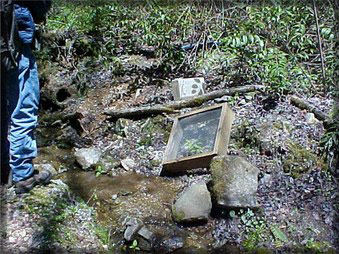
And still, people wonder why many places in our National Forest are closed or under restrictions! If you bring it in..take it out! If you dig a hole, cover it up before you leave! I noticed a work order a few years back on the NF website, stating the area around the mine was to be cleaned and holes back-filled..this was your last warning from the Forest Service!!
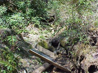
Most of the time that was spent at the mine was trying to "see" where the different sections of the past fit with the site today. It was hard because of the over-grown area didn't allow a good view... 120 years ago, this site was cleared!
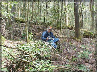
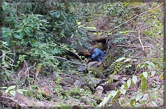
We did manage to find some time to scratch around! I worked an over-hang near the "Big Cut" for about 30 minutes.
Let's zoom-in for a closer look, "E"!
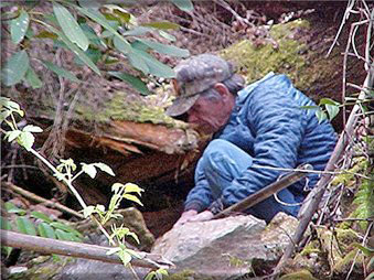
I had placed the shovel spade on the end of my walking stick and pulled gravel from under the over-hang that was on my right side. You can't tell from the picture, but I wasn't sitting down and was on my feet the whole time! When I started to leave, I thought I would need to be surgically removed from that tight spot!!
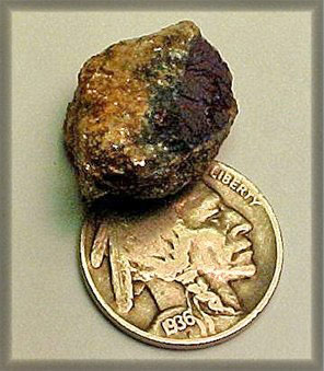
The Laurel Creek Corundum Mine is noted to have "blue", which I think is a nice color for sapphire.. don't you! In the past, several stones were reported to be cut to gems. In the old books, when they say "sapphire" the color was always blue, other colors weren't viewed as "gems"! Star corundum and other colors were made into grinding wheels for hardened steel or used as an abrasive for glass work... oh, well.
We did manage to find a few small pieces of corundum with parts being blue and a nickel size of solid dark blue with a coating of margarite.
Up to this point the best entry is still from the private property. But, now I know we can reach the mine without saying "May I?!" Other routes are being looked at and I'm sure we'll take a peak at all of them. We may not return until the fall, but this was a real good first trip and a nice spring walk that answered many questions. It would be great to plot the formation and maybe find another "Big Block" called... NUMBER9!!
CLICK THE LITTLE MINER TO RETURN TO THE FIELD TRIP PAGE