We spent some quality time during our Spring 2009 vacation rockhounding in southern New Mexico. It was then by chance we met Mr. Eddie DeLuca, who stopped by to introduce himself while we were collecting in what we thought was open BLM land near Orogrande. This perhaps was not a huge coincidence because we had
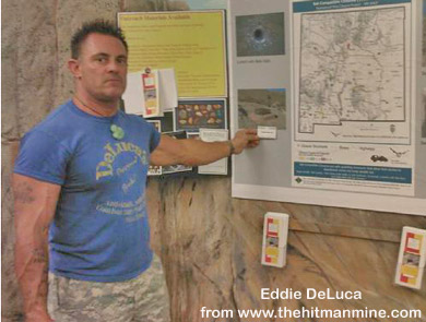
seen several claim markers in the area that bore Eddie's name. We were quick to point out that we did not access any posted land, but turned around when we came upon any claim markers. Eddie informed us that we were on property that was under claim by another individual, but was not marked. We apologized and would have left, but after an extended conversation, we discovered that we had a great deal in common with him. Eddie informed us that he had permission to access all the property in the district and he graciously extended the privilege to us during our stay and a new friendship was born. He told us a lot more about the different types of claims and how they work and I'll write about this very important information later in this report.
After hitting if off so well, Eddie gave us a brief tour of the area and some excellent collecting advice. We even extended our stay for an extra day to check out a couple locations that he suggested. When we headed home, we were happy to have not only been provided the opportunity to collect some killer rocks and minerals, but to add Eddie in our list of friends. During the proceeding year, we kept in touch and made lots of trades - I made over 60 cabochons and Chrissy wire wrapped around 20 cabs for him as trade for cutting rough and mineral specimens. To say Eddie is generous would be an understatement.
We made tentative plans to return to Eddie's neck of the woods, hopefully during the spring of 2010. But, these plans looked as though they would have be put on hold in early October, as the bad economy took its tool on our household and Chrissy was laid off her job of over 9 years. But, a bad job market couldn't keep Chrissy down as she managed to secure another position after only a few weeks of unemployment. Knowing that we would not likely be able to take an extended vacation next spring since Chrissy would have only been working her new job for about 6 months, her future employer agreed to allow her to take two weeks before starting. So, no time like the present to go visit our buddy, Eddie, who offered to show us around the Orogrande and Hansonburg Mining Districts where he owns many mining claims. So, with only a few days notice, we along with Opal were in the truck heading west bound for Alamagordo, New Mexico and beyond. The following is my day by day report of our New Mexico adventure.
After two days hard driving, we arrived at the Alamagordo Roadrunner Campground late Monday morning where we set up our folding camper. Although we had planned to begin rockhounding the next day, there we were at noon with not a whole lot to do, so we decided to drive the 35 miles out to Orogrande to at least reacquaint ourselves with the area. Eddie would not be available to come out and play until Wednesday, so we'd be on our own for the next day and a half, although he had offered plenty of advice as to where and what to collect. But, before I continue with our adventure, allow me to offer some background information about the Orogrande Mining District.
The Orogrande Mining District, located in the Jarilla Mountains in Otero County, New Mexico, is a past producer of gold, silver, copper, lead, iron and turquoise. According to the "Geology of the Ore Deposits of the Orogrande Mining District, Otero Co., NM by Robert North, 1982, New Mexico Bureau of Mines, the ore deposits, with the exception of turquoise, occur as late-stage veins and limestone replacement deposits in skarns associated with the intrusion of a Tertiary monzonite-quartz and monzonite stock complex. The turquoise was formed during the supergene alteration the stock.
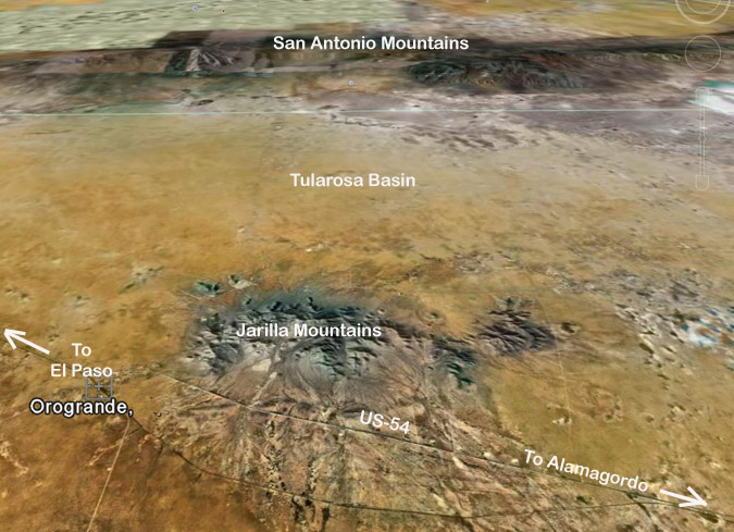
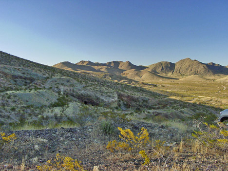
Westward View of the Jarilla Mountains Area from Google Earth
The first mining in the Jarilla Mountains was by Native Americans who worked shallow turquoise pits in the area. These workings were rediscovered and worked in the late 1890s by Amos J. DeMeules, a dealer in turquoise and precious stones. Large scale turquoise mining was suspended soon after DeMeules was killed in 1898, but has continued intermittently to the present on a smaller scale.
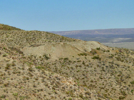
J.M. Perkins is credited as the earliest white prospector in the district arriving in 1879. By the late 1890s, mining had reached such proportions that the El Paso and Southwestern Railroad constructed a line to the settlement of Brice in the Jarilla Mountains. In 1907, the Southwestern Smelting and Refining Company (SWS&R) completed a 50-mile long water pipeline from the Sacramento River that supplied around 500 gallons per day to the mining community. This peaked the mining and investment interest in the district. Also in 1907, the SWS&R planned and built a smelter that was operated off and on until 1910. In 1916, The El Paso and Southwestern Railroad completed an extension of their line into to the heart of the Orogrande Mining district and significant base metal production continued until around 1918. Since then, work in the Orogrande district has been sporadic with peak interest during the depression, the mid 50s, the late 60s and late 70s. As it stands today, nearly all of the Orogrande Mining district is under claim by various parties and the only "mining" being performed is by rockhounds for fine mineral specimens and lapidary material, including unique turquoise.
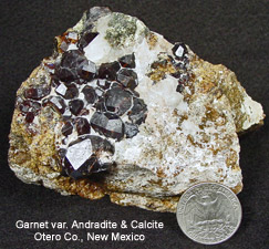
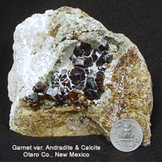
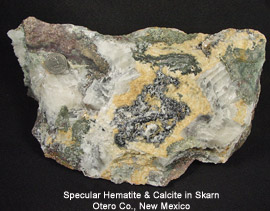
The list of collectable rocks and minerals is long; the most notable include: garnet (grossular & andradite), quartz, malachite, azurite, silicified chrysocolla, turquoise, pyrite, chalcopyrite, limonite after pyrite, hematite (including massive and specular), chalcedony, agate, large euhedral orthoclase crystals, galena, fluorite, diopside, epidote, magnetite and numerous lapidary rocks suitable for cabbing.
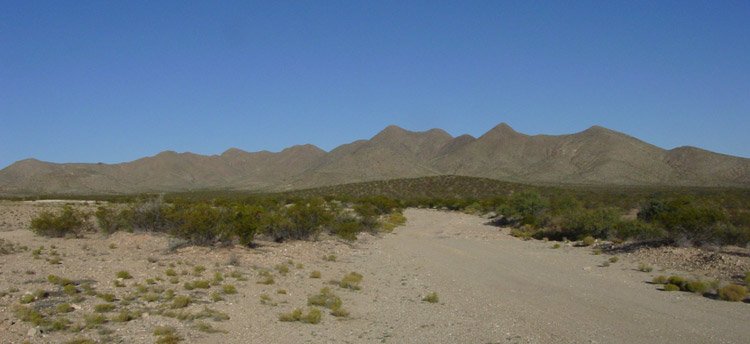
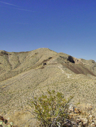
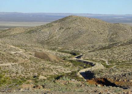
The Jarilla Mountains is a relatively small range (4 miles wide by 10 miles long) that rises like an island to 1,200 feet above the surrounding Tularosa basin. This range can be seen for many miles and are therefore easy to find. However, what is not always easy is negotiating its desert roads because of sharp rocks and washed out areas.
With the "Fall-back" time change having just taken place, we only had a few hours before it got dark, so we checked out a couple spots where we experienced success during our last trip there. We drove up a rather treacherous road to a garnet location where we found some excellent specimens.
Click on specimen pictures to enlarge
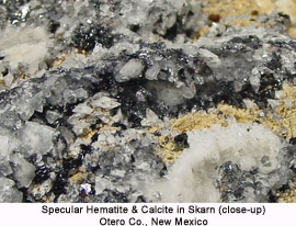
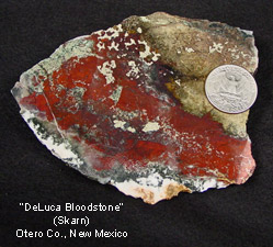
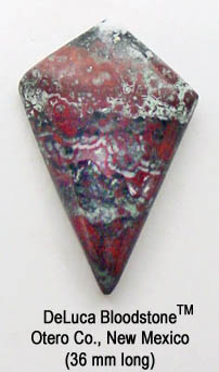
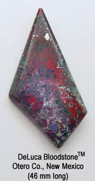
After digging for a couple hours, we made our way over to a location that Eddie had shown us where rock with mostly specular hematite and calcite along with red and green colored cabbing rock he calls "DeLuca Bloodstone" can be found in abundance.
Click on specimen pictures to enlarge
 (Cabochon pictures do not enlarge)
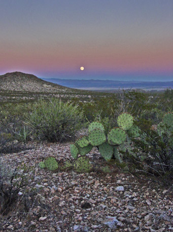
Long shadows on the hills told us that it was time to leave so as to not get caught in the dark. We hoped the full moon rising in the east was a good omen for the days to come.
Report continued . . . . . . .
Click Here for Next Page